
A team from Cornell University has been mapping the location of the most photographed places on earth.
The team of David Crandall, Lars Backstrom, Dan Huttenlocher and Jon Kleinberg used a data set of 35 million images taken from Flickr.

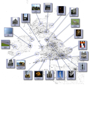
Download the GOOGLE EARTH KML file to check them out...
Check the website for some MAPS SHOWING LOCATIONS of the most photographed sites.
Thanks to DavidBittern777 from SLN Forum for the tipoff...
Also featured on the WIRED UK website - keep an eye out for the magazine...
Images courtesy of http://www.cs.cornell.edu/~crandall/photomap/
Comments